
Thoughts on Mobile Monday's Geo session and Ordnance Survey
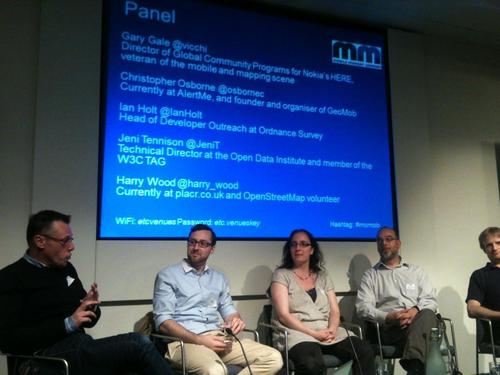
This Monday evening I attended a Mobile Monday London event. It was my first time at this event, I’m not much into the mobile scene but I was drawn by the event’s geo theme. I’m friends with several of the panelists (pictured below) and enjoyed a good discussion. Many thanks to the organizers for an agreeable evening.
The event was generously sponsored by the Ordnance Survey, who were promoting their new OpenSpace SDK. In the post panel drinks several of us were talking about whether, as service developers / entrepreneurs we would be drawn to using OpenSpace. Frankly I think they will face a very difficult and uphill struggle. The Ordnance Survey’s data and maps are no doubt excellent, but they have one major weakness: they are limited to the UK. I can think of very few services I’d want to build that limit my audience to just the UK. No doubt there are some (and those services might be very high margin, niche is where the money is), but the economics of building a consumer service are largely fixed (ie engineering time), so I need to try to spread that cost over as large a potential audience as possible. This means targetting a global, or at least globally English-speaking, audience. And if I know I’m building for a global audience from the start, then I much prefer a geodata or map provider that I can use globally rather than having to add country specific complexity (if in UK use Ordnance Survey, if in X use Y ….).
Relatedly, during the event I also spoke with a few people about our (Lokku’s) new service OpenCage Data, (I’ll do a post about OCD soon, check it out and you’ll see we help organizations use OpenStreetMap data). Perhaps due OrdnanceSurvey’s sponsorship of the event people were quick to start a OrdnanceSurvey (proprietary) versus OpenStreetMap (open) discussion. But for me there are very few use cases where the two are directly interchangeable. From my own experience at Nestoria (and leaving aside the whole issue of cost) using country specific datasets, no matter how detailed, is a difficult proposition. Our main bottleneck is engineering time. In a global product game it’s more efficient to work with one “good-enough” datasource like OpenStreetMap than many perfect ones. And this is the reason I’m convinced global players, be they open like OSM or private like Google will “win” in the consumer space. Sheer global scale.
Just to clarify, I wish Ordnance Survey well (not least because it would otherwise be churlish of me to have knocked back the free geobeers they funded on Monday). But in the consumer space I think the race for global scale will increasingly consign them to a very niche role.
BTW - anyone in London looking for more geo innovation in an event format should attend #geomob. Our next event is July 11th, hope to see you there.